
A commercial drone program swaps a truck roll, a scaffold, or a crew on a roof for a short flight and a repeatable set of images. That trade is the whole business case, and it is why utilities, surveyors, construction firms and public safety teams keep expanding their fleets.
This guide covers what to buy in 2026, which specifications decide whether a mission produces usable data, and the US rule change that now shapes every purchase. Both the equipment and the licensing path are well established: the FAA lists 367,848 registered commercial drones and 223,634 certified remote pilots in the United States (FAA, UAS by the Numbers).
Three terms first, so nothing later depends on jargon. A payload is whatever the aircraft carries, usually a camera, a thermal sensor or a laser scanner. RTK, or real time kinematic positioning, is a correction technique that pulls location accuracy from metres down to centimetres. Photogrammetry means building a map or 3D model by stitching overlapping photos together.
DSLRPros, the authorized dealer referenced below, is a DJI Enterprise Gold Partner and Autel Robotics dealer. It has equipped police, fire, search and rescue and inspection teams across the US since 2012. Call +1 (877) 299-1075 or email to match a platform to your operation.
Key Takeaways
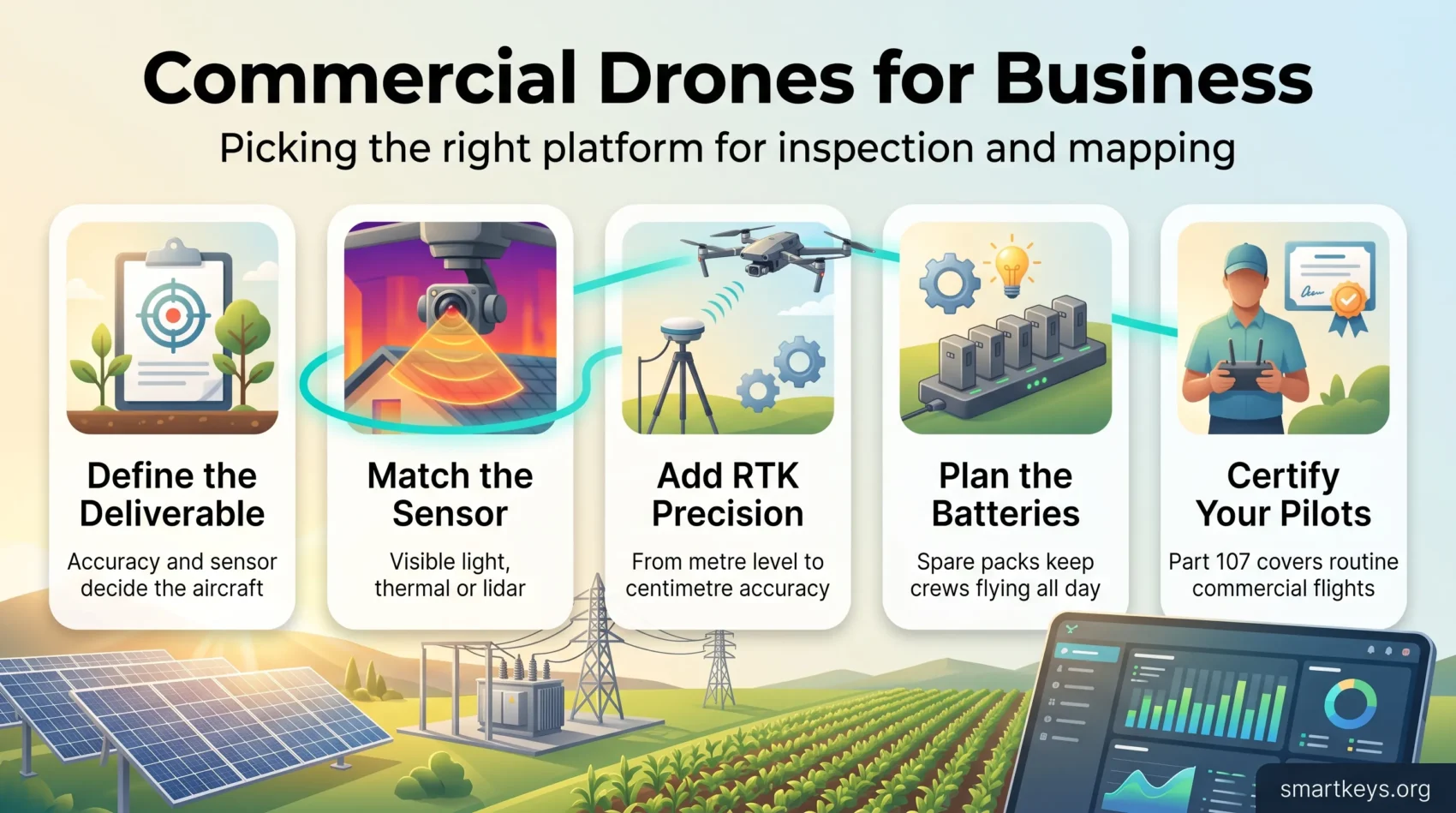
- Define the deliverable first. The sensor and the accuracy you need decide the airframe, not the other way round.
- Since December 2025 the FCC blocks new foreign made drone models from US authorization. Models already approved stay legal to buy and to fly.
- Budget batteries, spares and chargers with the aircraft. They decide how many flights a crew completes in a day.
- Add RTK when a repeatable coordinate matters. Skip it when you only need a picture.
- A Part 107 certificate covers routine commercial work. Flying beyond visual line of sight still needs a separate waiver.
- Buy from an authorized dealer so training, warranty and spare parts arrive with the hardware.
Why commercial drones are transforming operations right now
The slow part of an inspection was never the inspection. It was getting a person safely to the thing being inspected.
The immediate gain is removing that trip. A substation check that once needed a bucket truck, a two person crew and a partial shutdown becomes a short flight from the perimeter. That means fewer truck rolls, less time at height, and imagery shot from the same angles every visit, so quarters are comparable.
Where you will see the return first
Recurring inspections pay back fastest, because the same flight plan runs again and again. Roof surveys, solar array checks, tower climbs and stockpile volumes all fit that pattern.
In agriculture the value is earlier detection. A thermal or multispectral pass shows crop stress days before it is visible from the cab, so water and spray go where they are needed rather than across the whole field.
Public safety teams use aircraft differently: overwatch before a crew goes in, and a searchable record afterwards. The underlying shift is the one predictive maintenance brought to factory floors. Cheap, frequent measurement replaces expensive, occasional inspection.
Matching aircraft capabilities to your field conditions
Pick an aircraft that survives your worst normal day, not your best one. Wind, dust, rain and cold all cut flight time and steadiness.
- Payload headroom: leave rated capacity spare so you can add a sensor next year without buying a new airframe.
- Stabilization: a stabilized gimbal keeps shots usable in wind, which matters most on tight urban sites.
- Flight profile: short hops for spot checks and long endurance for corridor mapping are two different aircraft.
The 2026 rule that shapes every drone purchase
This is the part buyers most often miss. In December 2025 the FCC added foreign produced drones and critical drone components to its Covered List, after the security review required by the 2025 defense authorization act went uncompleted.
Being on that list means new device models can no longer receive the FCC authorization required to import, market or sell them in the United States.
It is not a ban on the drones you already own. The FCC stated that the restriction does not affect drones already purchased, or models that previously received authorization. Existing fleets stay legal to fly, and approved models can still be sold from stock. The Department of Defense and the Department of Homeland Security may grant exceptions for systems they judge to pose no risk (DroneLife, December 2025).
Two consequences follow. First, stock now matters more than the spec sheet: several US dealers list the Matrice 350 RTK as discontinued, and popular Autel bundles show as sold out. Second, if you are standardizing a fleet, buy spare batteries and parts with the aircraft rather than assuming the model will still be on the shelf in two years. Public sector buyers also face state and grant level rules. The same security review pattern is spreading across enterprise technology, as our guide to AI regulation in 2026 describes.
How to choose a platform: payloads, flight time, sensors and software
Start from the deliverable, not the drone. Write down what the asset owner needs: a labelled photo set, a survey grade point cloud, a thermal report, or a stockpile volume. That one line settles most of the other choices.
Battery life and power management
Set a minimum usable flight time and a payload budget before you shortlist anything. Published flight times are measured with no wind, at sea level and a light payload, so treat them as a ceiling, not a plan.
DJI rates the Matrice 400 at 59 minutes carrying a single H30T camera in windless conditions. Add wind, a second sensor and a reserve for the return leg, and a realistic mission plan lands well below that.
For corridor work, dual battery designs and hot swapping keep the aircraft flying while packs rotate through the charger. Treat spare batteries and a fast charger as part of the purchase: they decide how many sorties a crew finishes before the light goes.
Camera options: thermal, RTK, lidar and gimbal stabilization
The sensor defines the deliverable. High resolution visible light cameras suit photogrammetry and documentation. Thermal finds what visible light hides: a hot connector, a wet patch under a roof membrane, a dead cell in a solar string. Lidar fires a laser and times the return, so it captures ground under vegetation and thin structures such as power lines, where photo stitching fails.
Pair thermal with a visible light camera on the same flight, so every finding has a matching photograph in the report. For survey grade output, add RTK and keep clean logs.
Data workflows and software integration
Match two things to the accuracy you promised: ground sampling distance, which is the real world size of one pixel, and image overlap. Flying higher is faster and less accurate, and there is no way around that trade.
Choose your mission planning and processing software before the hardware arrives. The common failure is a hard drive of imagery nobody can turn into a deliverable.
- Match payload weight to rated capacity, and plan storage for high volume sensors. Lidar files are large.
- Confirm compatibility between aircraft, payload and software before buying any of the three.
- Standardize file naming and export formats from day one. Retrofitting that across a fleet is the slow work any data governance programme runs into.
DJI Matrice: the 350 RTK and the newer Matrice 400
DJI’s Matrice family is still the default for enterprise inspection and mapping in the United States. The line moved on in 2025, when the Matrice 400 arrived above the 350 RTK.

Matrice 350 RTK: the proven workhorse
The 350 RTK is built for fleets that fly every working day. DJI rates it at up to 55 minutes aloft without a payload, a 20 km transmission range under FCC rules, and RTK positioning accurate to 1 cm plus 1 ppm horizontally.
That positioning is what makes repeat inspections comparable: the aircraft flies the same line to within a couple of centimetres, so images align between visits and small changes stand out. Six directional sensing, dual GNSS and redundant flight controls cover safety on active sites. Check stock first, because several US dealers now list it as discontinued.
Matrice 400: longer endurance, heavier payloads
The Matrice 400 is the newer flagship. DJI publishes 59 minutes of flight time with a single H30T camera, 6 kg of payload capacity and a 40 km FCC transmission range. Obstacle sensing combines binocular vision, a rotating lidar with 100 m reach and six direction radar.
It takes the Zenmuse L3, H30, H30T, L2 and P1 payloads, plus a parachute, spotlight and speaker. DSLRPros lists it at $10,300, batteries and charging sold separately, and shows it out of stock at the time of writing. Quick swap gimbal mounts on both airframes let one aircraft cover a substation in the morning and a facade survey in the afternoon.
Autel EVO II: compact drones with thermal options
If you need something that travels in a car boot but still carries a professional sensor, the Autel EVO II series is the realistic alternative to a Matrice.
EVO II Dual 640T V3 for thermal inspections
The EVO II Dual 640T V3 pairs a visible light camera with a 640 x 512 thermal sensor, enough resolution for roof surveys, solar array checks and electrical inspections. Autel publishes 38 minutes of flight time and a 15 km transmission range, and lists the Rugged Bundle at $4,799 on its own store, currently sold out. Thermal is worth the premium only when heat is the signal; for cracks or asset counts, a visible light camera does the job for less.
EVO II Pro 6K for high resolution mapping
The EVO II Pro 6K Rugged Bundle V3 is the mapping and documentation option. It carries a 20 megapixel one inch Sony sensor with an f2.8 to f11 aperture, and Autel publishes 40 minutes of flight time. Autel lists it at $2,099. Both bundles ship with a case and accessories, so a crew deploys from the car rather than a workshop. Autel is a Chinese manufacturer, so the FCC Covered List applies to its new models as it does to DJI’s.
Heavy lift and spraying platforms for agriculture and energy
When a mission needs lifting power rather than a camera, a purpose built heavy lift frame changes what you can carry and how few sorties it takes.
Start small and scale. Fly a demo frame first to check mounts, balance and spray pattern before buying a fleet.
- Field work: spraying and seeding platforms cover acreage faster than a ground crew, with more even application and less human exposure to chemicals.
- Remote sites: heavy frames carry sensors or spare parts where there is no road access, a niche that overlaps with autonomous delivery in logistics.
- Licensing: dispensing chemicals is not a Part 107 job. The FAA requires an Agricultural Aircraft Operator Certificate under Part 137 plus specific exemptions, and aircraft over 55 pounds need an N number rather than an FA number.
- Flight planning: balance and power draw shift as the tank empties, so plan conservative envelopes and carry spare packs.
- Logistics: bigger airframes need transport cases, ground support and secure charging to keep sorties stacking through a peak day.
Pro tip: get advice on liquid handling, nozzle choice and tank balance before the first paid job. Those three decide whether coverage is even.
RTK, precision and data accuracy in the field
Precise positioning is what turns nice imagery into evidence somebody will sign off on. Without it you have pictures; with it you have measurements that survive a surveyor’s check.
Standard satellite positioning puts an aircraft within a few metres. GPS satellites orbit roughly 12,550 miles above Earth, and most of the error comes from the signal being distorted on the way through the atmosphere.
RTK fixes this with a second receiver on the ground in a known position. It measures the current error and sends a correction to the aircraft in real time. Accuracy moves from metre level to centimetre level, a hundredfold improvement rather than a marginal one. You get less post processing, and coordinates you can return to next year.
Speed control matters as much as position. Enterprise controllers let a pilot cruise between sites, then crawl for delicate alignment against a structure. Slow passes capture more usable frames per battery, so fewer flights are wasted.
Fitting a drone program into the rest of your stack
Aerial data rarely lives alone. Point clouds feed digital twin models of buildings and plants. Inspection findings become work orders in the same systems that drive robotics automation on the ground. Telemetry joins the same IoT platform as fixed sensors, and on large industrial campuses the site link increasingly runs over private 5G networks.
Processing is also moving closer to the site, part of the wider shift toward edge AI. Whatever the stack, add fleet tooling that logs maintenance intervals, battery cycles and pilot hours. That record is what an audit asks for.
Where to buy, train and scale your fleet
Start with a single point of contact for procurement, training and after sale support. That is what keeps equipment, software and procedures consistent as the program grows.
Authorized dealers and ready packages
Buy from an authorized US dealer that understands your sector, whether that is police, fire, search and rescue, agriculture, utilities or surveying. DSLRPros has supplied DJI Enterprise and Autel platforms with warranty support since 2012, and also carries AgEagle fixed wing mapping aircraft, Pix4D processing software and Airdata fleet management. A bundled package gets a team flying sooner than assembling parts from four suppliers, and leaves one warranty conversation instead of four.
Pilot certification and training
A commercial remote pilot in the United States needs an FAA Part 107 certificate, which covers routine work within visual line of sight. Flying beyond visual line of sight still requires a waiver or exemption. The FAA’s proposed Part 108 rule, published in August 2025, has not been finalised, so nobody can operate under it yet.
Beyond the certificate, budget for payload and maintenance training. It shortens ramp up and cuts downtime, and the same logic applies as in any upskilling effort; VR training and AR on the job training are now common for field crews. Train at least two pilots per aircraft so one holiday does not ground the program.
Contact DSLRPros: call +1 (877) 299-1075 or email for help selecting a platform, adding thermal sensors and planning a rollout.
Conclusion
Shortlisting comes down to three numbers: the accuracy you must deliver, the minutes aloft you need, and the payload you have to carry. Fix those and the candidate list shrinks fast.
For enterprise inspection the DJI Matrice line still leads on range, redundancy and payload choice, with the Matrice 400 now above the 350 RTK. For compact work the Autel EVO II Dual 640T covers thermal and the EVO II Pro 6K covers mapping at a far lower entry price.
Two things decide whether the program still works after a month. Batteries, spares and a charging plan keep aircraft in the air. RTK plus disciplined flight planning stops you repeating missions because the data did not line up. And after the December 2025 FCC decision, buy the spares while the model you standardized on is still in stock.
Next step: talk to an authorized US dealer about a package, training and lifecycle support, so the first flights produce the data stakeholders actually asked for.
Found this useful?
Make SmartKeys a preferred source on Google, and our articles will surface more often in your Top Stories, AI Overviews, and AI Mode.
Add as Preferred Source